
Congratulations! Your promo code PROMOCODE will be automatically applied when you check out – enjoy.


The 3D ImageVector — MONO — allows the acquisition of final image centers in terrestrial photogrammetry. You get ”direct georeferencing” for surveying, using terrestrial or UAV photogrammetry. There is NO need for ground control points for georeferencing! The 3D ImageVector — MONO — is used for following sectors: surveying, infrastructure, architecture, archaeology, UAV pilots, etc.
AIM
The 3D ImageVector — MONO — records the GNSS RINEX data (or corrected GNSS position data) and the solid angle determination via IMU. Trigger information with a resolution of 30 ns (nanoseconds) is recorded for each image. The 3D ImageVector achieves a position accuracy of 8cm (PPK, depending on the reception) and an angular accuracy of 1 °.
SPECIFICATION
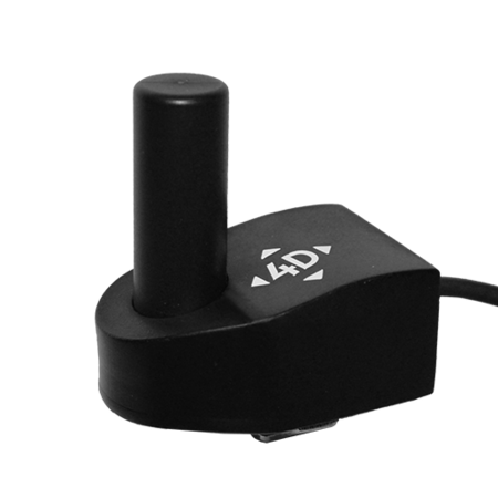
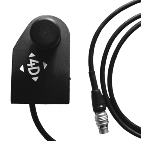
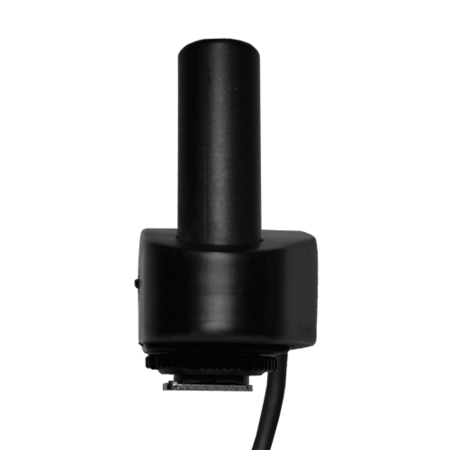
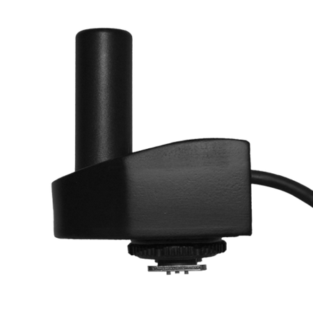
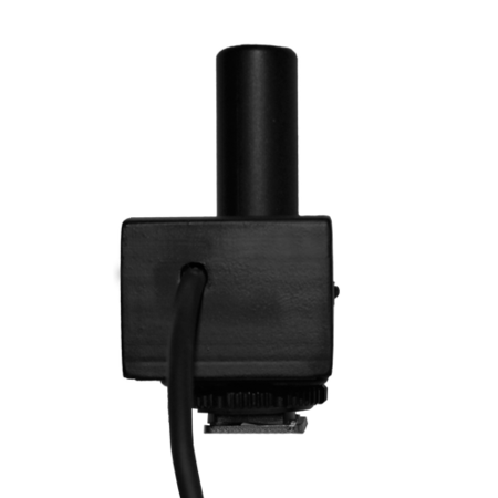
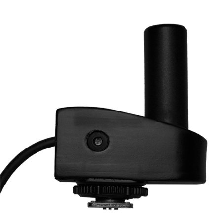
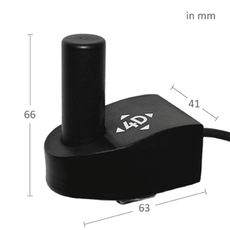
The 3D ImageVector – MONO – contains a modern ublox NeoM8P/T GNSS chip: GPS L1 C/A, GLONASS L10F, which achieves a position accuracy of 8cm with fixed solution, 40cm with float (depending on receiver). The Helix antenna provides better reception, even with a camera tilted to 45 °. Also the 3D ImageVector – MONO – includes a latest 9x Axis MEMS IMU with quaternion roughness and an anti-drift filter algorithm. The Connection to the camera is done via ISO or Sony hot shoe.
LOGGER
The logger has an autonomous power supply of approx. 4h during normal operation. The LEDs signal the quality of the reception. To reset the data, a new logfile button is attached.
CORRECTION DATA
To correct the position data in the postprocessing, RINEX data from an external source is needed, e.g. Correction data services (EPOSA, APOS, SAPOS, SWISSPOS, etc.), GNSS receiver which supports the recording of RINEX data, ReachRS Emlid, etc., or the REDcatch BaseStation (PC version or StandAlone).
RED TOOLBOX
The REDToolbox is included in the purchase of one of our products. The REDToolbox is a geotagging software for combining the ImageVector logfile with the image data. The software performs a validity check of the GNSS signal and quality output. It is easy to use and calculates with robust algorithms. The following output data is created: Google Earth KML Output, Raw Data Output, AgiSoft Photoscan, Pix4D and Reality Capture Output. The REDToolbox is compatible with Win7, Win10 x64 / x32.
Whats in the Box?
- Camera add-on
- Data logger
- Charger
- USB data cable
- Software REDtoolbox.
