
Congratulations! Your promo code PROMOCODE will be automatically applied when you check out – enjoy.


PARROT BLUEGRASS FIELDS
MAP. SCOUT. ACT.
Parrot Bluegrass Fields is a comprehensive, ready-to-fly drone solution that spans the entire crop analysis workflow. Parrot Bluegrass Fields provides agriculture professionals with the insights they need to maximize their yields and boost the quality of their crops.
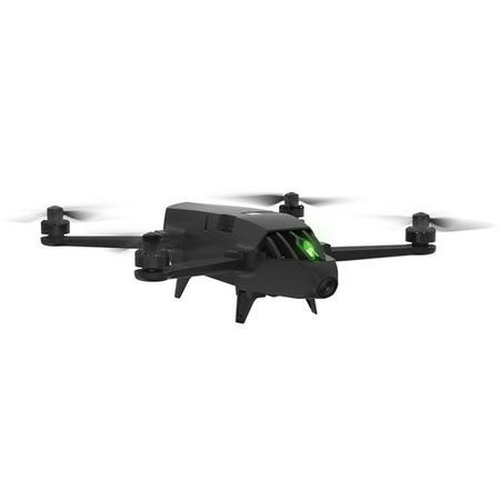
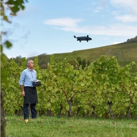
RUGGED, EASY-TO-FLY DRONE PROVEN QUADCOPTER FOR AGRICULTURE
This quadctoper by Parrot is designed for both Crop Mapping & Aerial Scouting which allows the user to fly high to cover large portions of fields or fly low for a much higher resolution.
With the Vertical take-off & Landing it makes it easier to get the drone in the air & you can fly for much longer on each job with 3 x batteries, 25mins each unit.
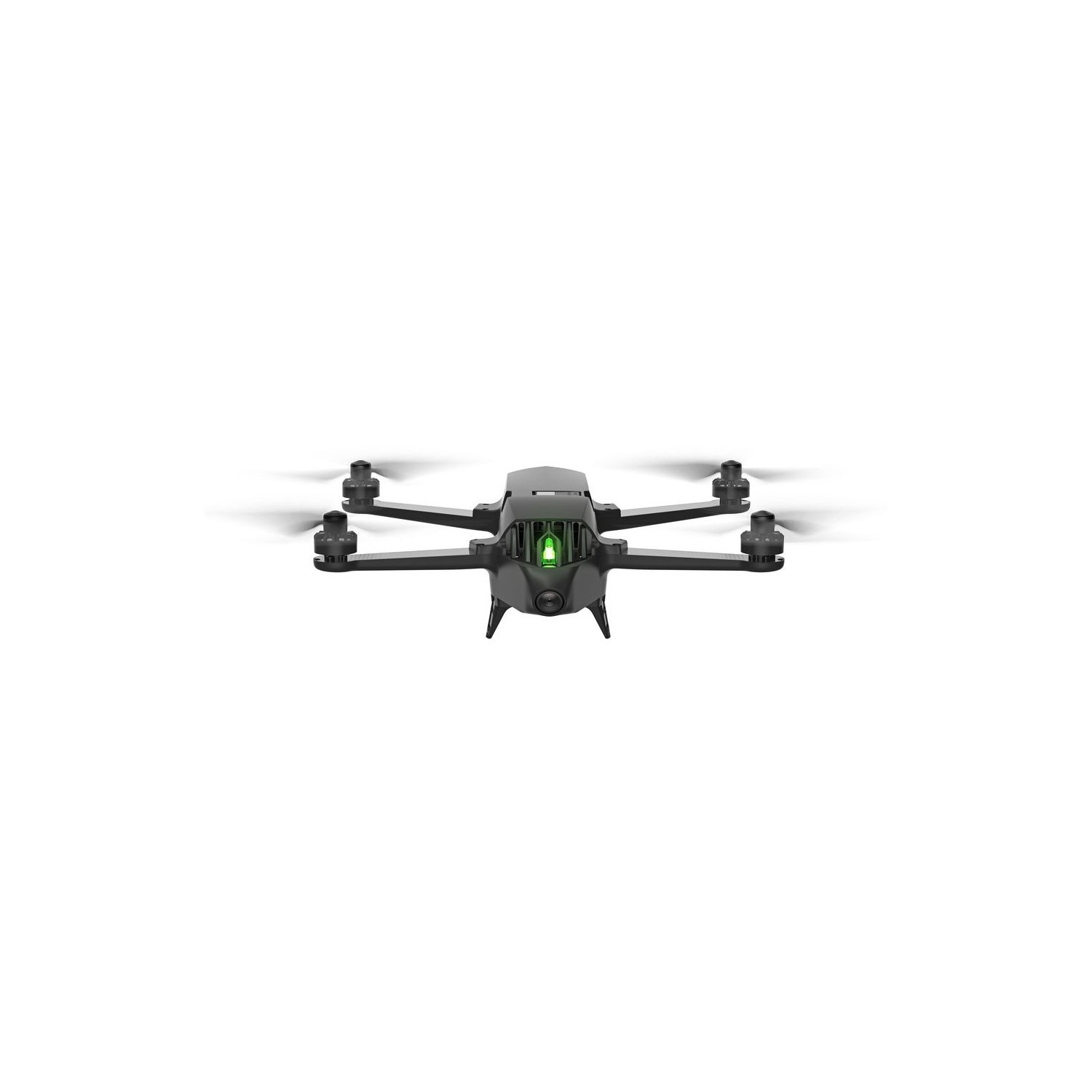
PARROT SEQUOIA MULTISPECTRAL SENSOR - MULTI-PURPOSE SENSORS FOR VISUAL SCOUTING AND CROP MAPPING
4 multispectral mono-bands, 1.2 MP, global shutter:
- Green (550 nm ± 40 nm)
- Red (660 nm ± 40 nm)
- Red Edge (735 nm ± 10 nm)
- Near infrared (790 nm ± 40 nm)
Multispectral GSD of:
- 0.9 cm/px at 10 m (0.35 in/px at 33 ft – single image)
- 2.8 cm/px at 30 m (0.8 in/px at 100 ft)
- 11.5 cm/px at 122 m (4.5 in/px at 400 ft)
Front 14 MP RGB camera with 3-axis digital stabilisation for fast, effective live scouting of problem areas, including the capture of both photos and full HD quality video (1080p)
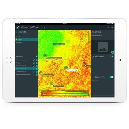
PARROTFIELDS MOBILE APP FOR AGRICULTURE - MAPPING AND SCOUTING MADE QUICK & SIMPLE
- Perform fully automatic flights or fly manually over your crops
- Generate NDVI maps in real-time during the flight
- Compare NDVI maps to monitor the evolution of your crops on your mobile device
- Explore areas of interest via unique semi-automated scouting flights
- Capture photos and videos on-demand with the Parrot Skycontroller 2
- Add text annotations and shoot photos directly from the ground
IN-DEPTH CROP ANALYSIS - FULL ACCESS TO PIX4DFIELDS DRONE MAPPING SOFTWARE FOR AGRICULTURE
- Identify in-field variability faster with the new instant processing engine
- Generate predefined or custom index maps for detailed crop performance analysis
- Visualize and understand crop trends by comparing different data layers side by side
- Create comprehensive zonation and prescription maps for more precise fertilizer applications
- Import or draw field boundaries and annotate the crop ‘focus areas’ for a more in-depth inspection
- Export prescription maps to your tractor or FMIS for seamless integration into existing agriculture workflows
“Processing speed coupled with great analytics, creates a product that brings true value to the customers. No other software can achieve this level of efficiency.” Nicholaus Helwig, Owner Pinpoint Aerial Solutions 1. Parrot Bluegrass Fields includes a one-year subscription to both the ParrotFields mobile app and Pix4Dfields software (desktop & cloud)
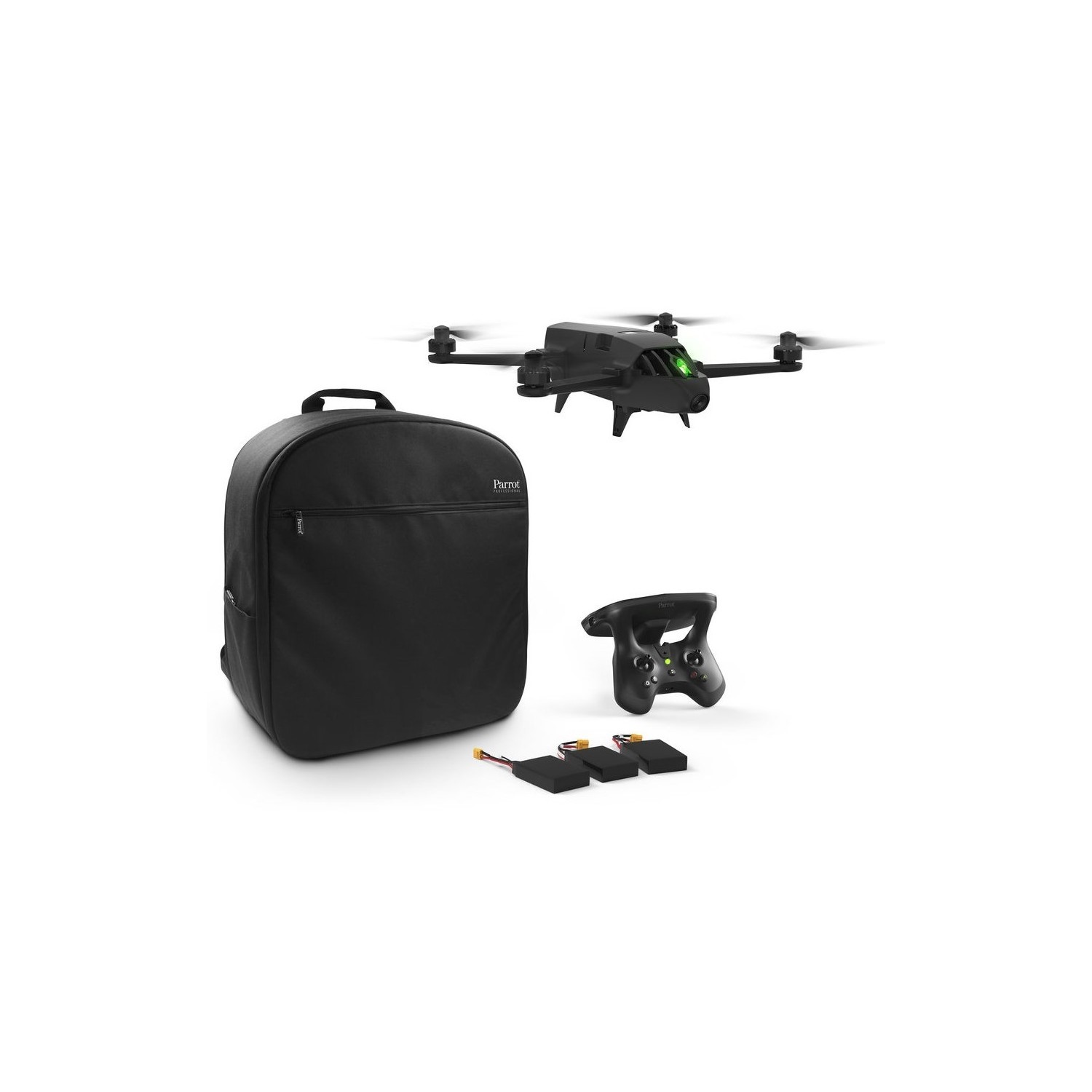
What's in the box?
- 1 x Parrot Bluegrass Drone
- 1 x Parrot Sequoia multispectral Sensor
- 3 x Batteries
- 1 x Battery charger
- 1 x Backpack
- 1 x Parrot Skycontroller 2
- 1 x Controller Charger
- 4 x Additional Propeller Blades
- 1 x USB-A Cable
- 1 year subscription to both ParrotFields mobile app & Pix4Dfields software (desktop & cloud)
